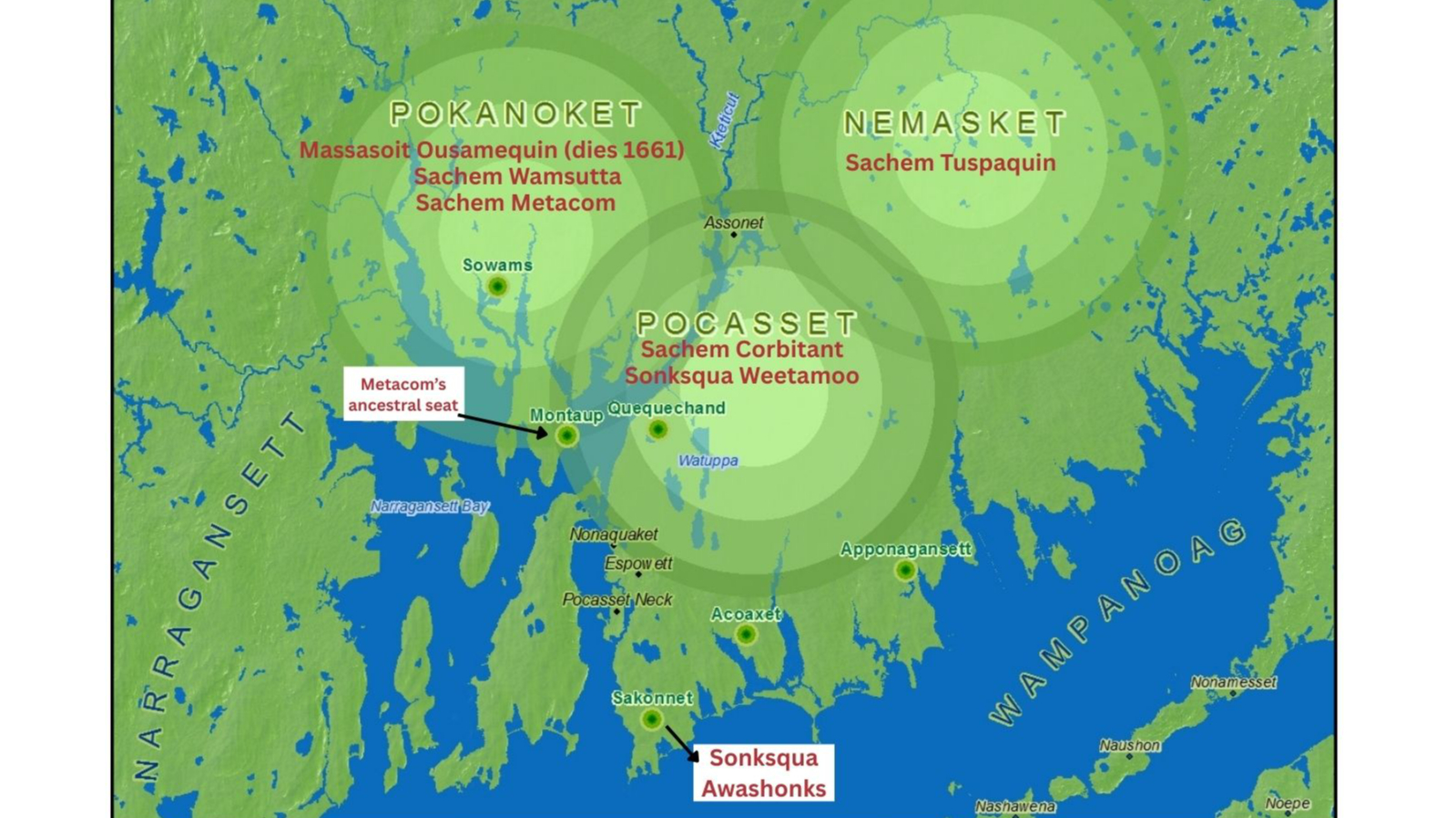
In this map, Wampanoag communities show the dynamic homelands of Wampanoag communities and the men and women who led them in the mid-1600s. The map identifies the homelands of the Pokanoket, led by Massasoit Ousamequin and his sons Wamsutta and Metacom; the Nemasket led by Sachem Tuspaquin, the Pocasset led by Sachem Corbitant and then his daughter Sonksqua Weetamoo, and the Sakonnet, led by Sonksqua Awashonks. During political negotiations and warfare with English colonists from the 1630s-1670s, Wampanoag communities worked to maintain and defend their sovereignty.